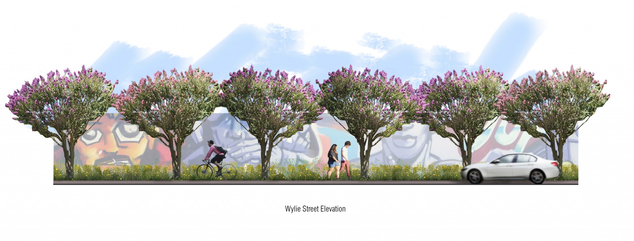
Design aims to reconcile the trail, vehicular traffic, and street parking in narrow space.
The Atlanta Beltline has shared images of what the Eastside Trail extension would look like at Wylie Street, where the trail would need to be reconciled with vehicular traffic and street parking in a tight space.
Sign up now to get our Daily Breaking News Alerts
A July 21 construction update notes that Beltline construction mainly takes place in old rail corridors, separating trail and transit from on-street traffic. In some areas, however, such as the Eastside Trail’s southern extension, the corridor does not connect perfectly and therefore needs to use roadways in order to complete the loop.
The update reads:
“With the old rail corridor terminating at Dekalb Avenue, the trail needs to continue by way of Krog Street and Wylie Street until it can return to the corridor near Flat Shoals Avenue. The challenge of construction down Wylie Street is accommodating the multi-use trail, vehicular traffic, and some on-street parking within a relatively narrow space.”
Design plans for the area include a 10-foot trail on the north side of the road using landscaping as a buffer. On the south side, existing street parking will remain, and new cross walks are forthcoming to accommodate pedestrians. Atlanta Beltline says in the update that bicycles would remain on-street, or could “walk their wheels” on the trail. In a July 22 update to the post, the organization clarified that cyclists would be encouraged to use the road but would also be permitted to use the trail.
With work on the extension having already begun, Wylie will undergo closures in the near future for this phase of the build.
[UPDATE 7/22 10:00 AM: The Beltline has updated their construction post to add that Cyclists are encouraged to use the road when traveling on Wylie Street to reduce congestion on the multi-use trail but are also permitted to ride on the trail.]

-
Facebook
-
Twitter
-
LinkedIn
-
Gmail

-
Facebook
-
Twitter
-
LinkedIn
-
Gmail
What do you think of the plans? Tell us below…


4 Responses
Beautiful renderings. Did not see how they are going to get trail through the Krog Street underpass at DeKalb Ave. Will another tunnel be built or old one made wider?
From Beltline site, they are just going to add lighting and handrail to the tunnel:
The 14-foot-wide concrete multi-use trail will run in the old railroad corridor from Irwin Street/Lake Avenue until it crosses under Edgewood Avenue and continues south to DeKalb Ave. At DeKalb, the trail will follow the road eastward on the north side to the intersection with Krog Street. The intersection will include a pedestrian scramble, with traffic halted in all directions so that folks on foot may safely cross. —-Lighting and handrail improvements to the Krog Tunnel will be part of this construction work. —At Wylie Street, the trail will be 10 feet wide and will follow the north side of the street until it reaches the corridor again between Kenyon Street and Flat Shoals Avenue. The trail will then follow the corridor south to the intersection of Memorial Drive and Bill Kennedy Way.
Last I heard, they were stopping at Kirkwood in this phase. Too much work needed to the bridge over Fulton Terrace. If that is the case, we’re talking 18 months to lay less than a mile Absolutely ridiculous. Please turn this project over to the Path Foundation………..
Just an update for clarity: Cyclists are encouraged to use the road when traveling on Wylie Street to reduce congestion on the multi-use trail but are also permitted to ride on the trail.
Sorry for any confusion!